Hi everyone!
The scenario given: We were a GIS analyst hired by the Municipality of Squamish to analyse through maps of The Garibaldi Resort's proposed area on its potential impacts on the environment.
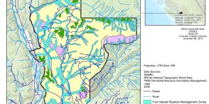
Here are the two maps created:-
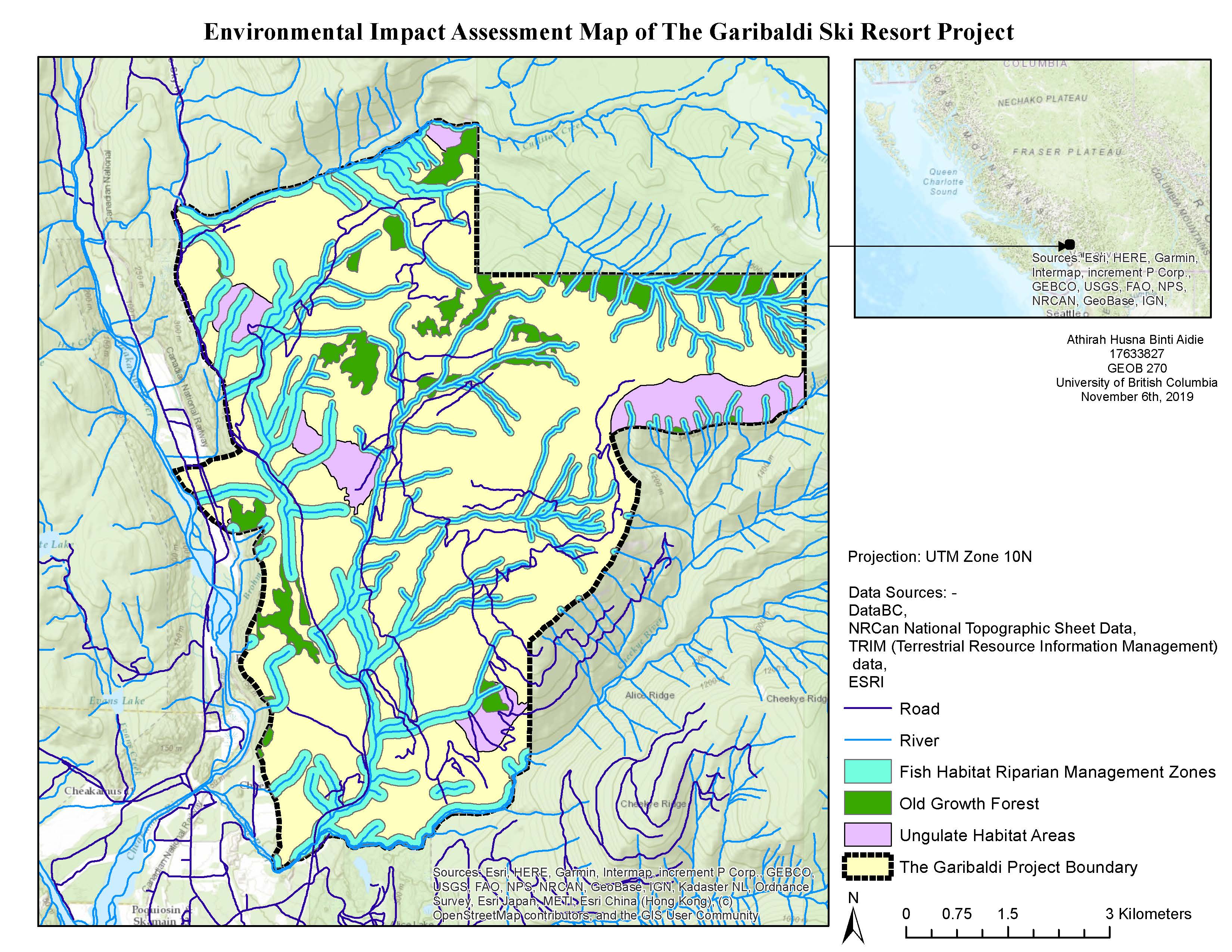
As a brief introduction, The Garibaldi is a year-round resort proposed to be built in a high-environmental-risk area next to Garibaldi Provincial Park. The proposed area is easily accessible by Sea-to-sky Highway.
The results of the analysis are as follows:-
The total area of the proposed project: 54 717 275.03 metre squared
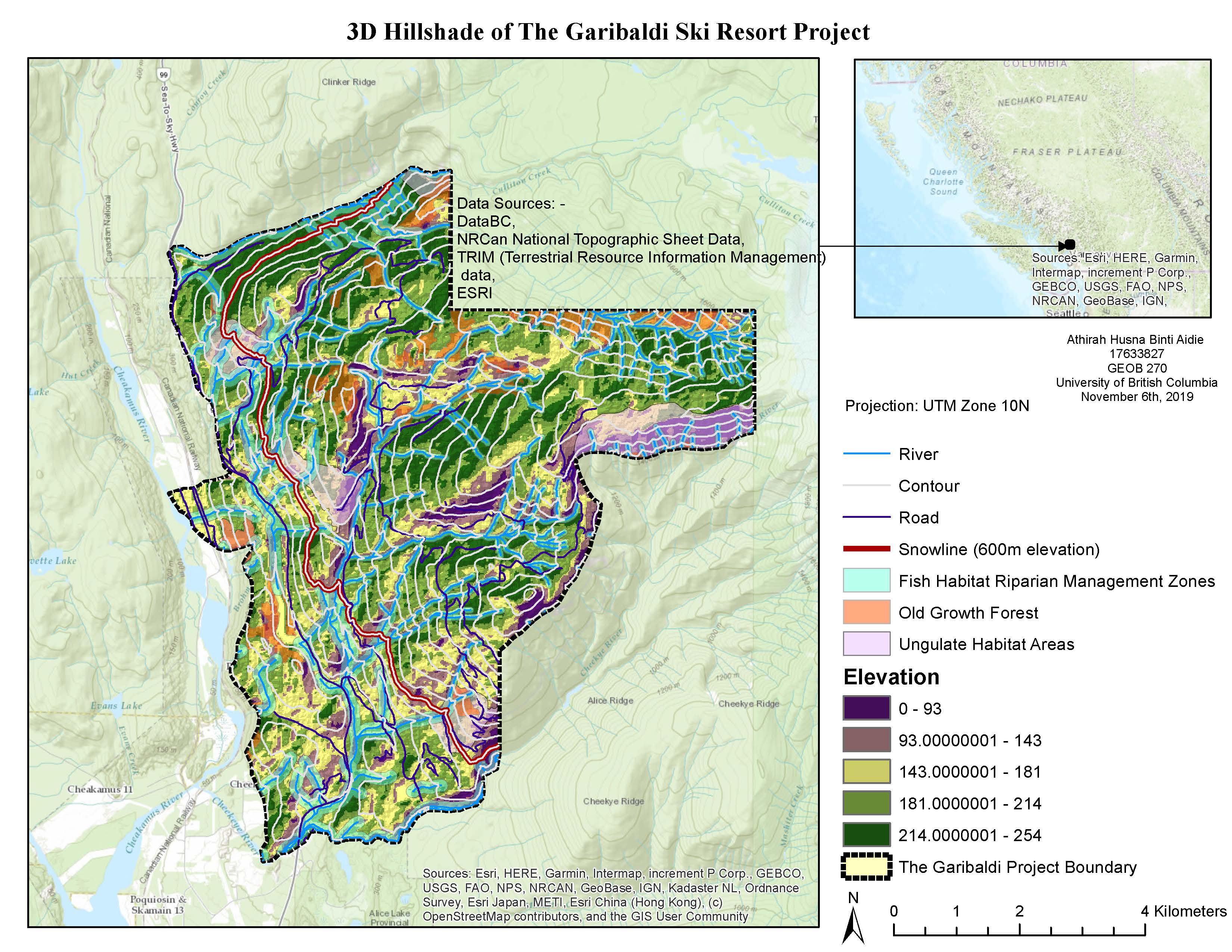
Percentage of the proposed project area lower than 600m elevation (i.e. under the designated snowline): 31.8%
Percentage of the project area consisting Mule Deer and Mountain Goat (ungulate) winter habitat: 7.89%
Percentage of the proposed project area consisting of old growth forest: 6.78%
Percentage of the proposed project area consisting of fish habitat riparian management zones: 28.35%
Percentage of the proposed project area containing these protected areas: 38.54% (The percentage of the protected area is not the simple sum of the 3 subfactors (i.e. the ungulate habitat, fish habitat and old growth forest) because some of these regions are overlapping with each other)
Based on this analysis, although the percentage of the proposed project area containing these protected regions are less than 50% (the percentage is 38.54%), most of these regions are consist of fish habitat riparian management zones and these fish habitat zones are sparsely distributed across the proposed area, instead of being concentrated at one particular region. This means that it might be impossible to build ski ramps without interfering with these fish habitat zones.
Furthermore, although the proposed area is not located in the Garibaldi Provincial Park, it is located right next to it, sharing the same borderline. Therefore, the construction of this project might disturb the wildlife in the provincial park with potential sound, water and air pollutions.
Next, the development of the proposed area being very near to Sea-to-sky Highway might impose a risk of landslides towards the highway. Besides, the proposed area that is close to this highway has an elevation of less than 600m (i.e. the possible snowline), which has higher environmental risks and therefore should be discarded from the proposed area.
There are several possible data errors and uncertainties in this analysis. First, the fish habitat riparian management zone is just an assumed area of 50m buffer (for above-snowline streams) and 100m buffer (for below-snowline streams) and thus are not based on any existing data. Hence, further analysis may need to include the exact data about fish-bearing habitats so that the analysis can be more accurate. Moreover, the data we used for ungulate winter range is a provincial-wide one and thus the data might not be as accurate as a specific regional data. Furthermore, there might be some discrepancy in areas between the vector layers (i.e. the ungulate winter range regions, old growth forest and fish habitat zones) and the raster layer used (i.e. the digital elevation models (DEM) layer) and this might affect the calculation for the percentage of protected areas. Next, there might be an error in DEM raster pixels whereby some pixels might not be marked with the correct elevations and thus the area below the snowline was probably not calculated correctly. There might also be errors in calculating the area percentages for each subfactor and the total protected area.
Further analysis that can be done is regarding the safety of the proposed area. A risk assessment of volcanic activities, landslides, avalanche and forest fire should be done. Besides, the total forest cover area that needs to be cleared for this project should also be analysed since this forest cover might be closely linked to the probability of landslides. Next, an analysis of other wildlife living in the proposed area should also be conducted. Furthermore, since this project is a year-round resort, the data of ungulate habitats during other seasons should also be analysed.
As a conclusion, it might be impossible to run this project without jeopardising the environment. However, the environmental risk might be able to be reduced if the proposed area is cropped to become smaller- only above 600m elevation, does not include the habitat zones and old growth forest and further away from the provincial park borderline. While ungulate habitat zones and old growth forest can still be protected, it might still be very difficult to protect the fish-bearing streams flowing through the proposed area.
Accomplishment statements:-
1. Visualised data by using Ben Fry's seven steps (acquire, parse, filter, mine, represent, refine and interact) as the foundation
2. Acquired geospatial datasets such as Ungulate Winter Habitat areas from DataBC website
3. Used ESRI ArcGIS overlay tools such as intersect and clip for GIS analysis
4. Worked with a digital elevation model (DEM) by reclassifying it based on its elevation and converting it into a polygon vector
5. Used the select by attributes tool to build queries for analysis
6. Wrote a brief memo containing the methodology, objectives and results of the analysis
That's all for now, thank you for reading!