Hi everyone,
As the term is coming to an end, we were tasked to complete a group-of-three project in which we need to incorporate GIS techniques and skills that we have learnt from the previous labs and lectures. In our group, inspired by Dr. Schwartz's example of the best place to hide in a zombie apocalypse in one of the class lectures, we wanted to do something similar to that- out of the box and seems fun to make. It was Bitanavi's idea to do a project of finding the most ideal locations to dispose of a body and we all thought that it was a great idea, thus proceeding with that idea for our final project.
In our project, we wanted to search for the most optimal zones of corpse disposal in British Columbia and just to give a context for our project, we made the University of British Columbia (UBC) as the hypothetical murder scene and the criminals would be trying to drive to the most ideal corpse disposal location from UBC. Factors that were considered for our analysis include low population density, high predators (example: grizzly bears, cougars and grey wolves) population density, low highway camera density, deep lakes, hazardous waste locations, rich soil nutrients areas, further from drinking water sources and the closest distance from UBC. We made four maps which each would take into account different factors but all of them would include low population density and low camera density in the analysis.
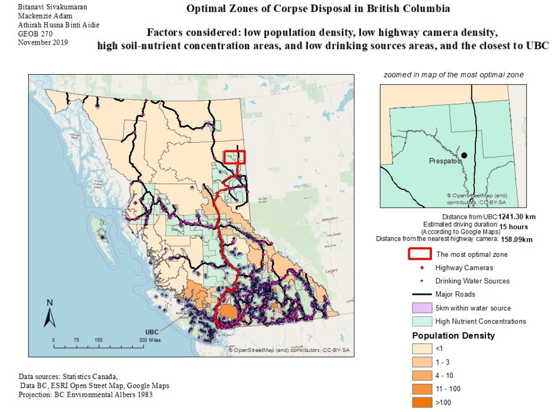
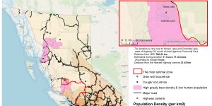
In Map 1, we chose high nutrient concentrations as the key attributes because, from our research, soils that are rich in nutrients would have a higher decomposition rate and this would be the perfect location to bury a corpse. Besides, we also tried to avoid places with drinking water sources since authorities regularly conduct drinking water tests at these locations. After considering these factors, we discovered that Prespatou, which is located 100 km north of Fort St. John is the most optimal zone for corpse disposal. However, it took approximately 15 hours to get to this location by car.
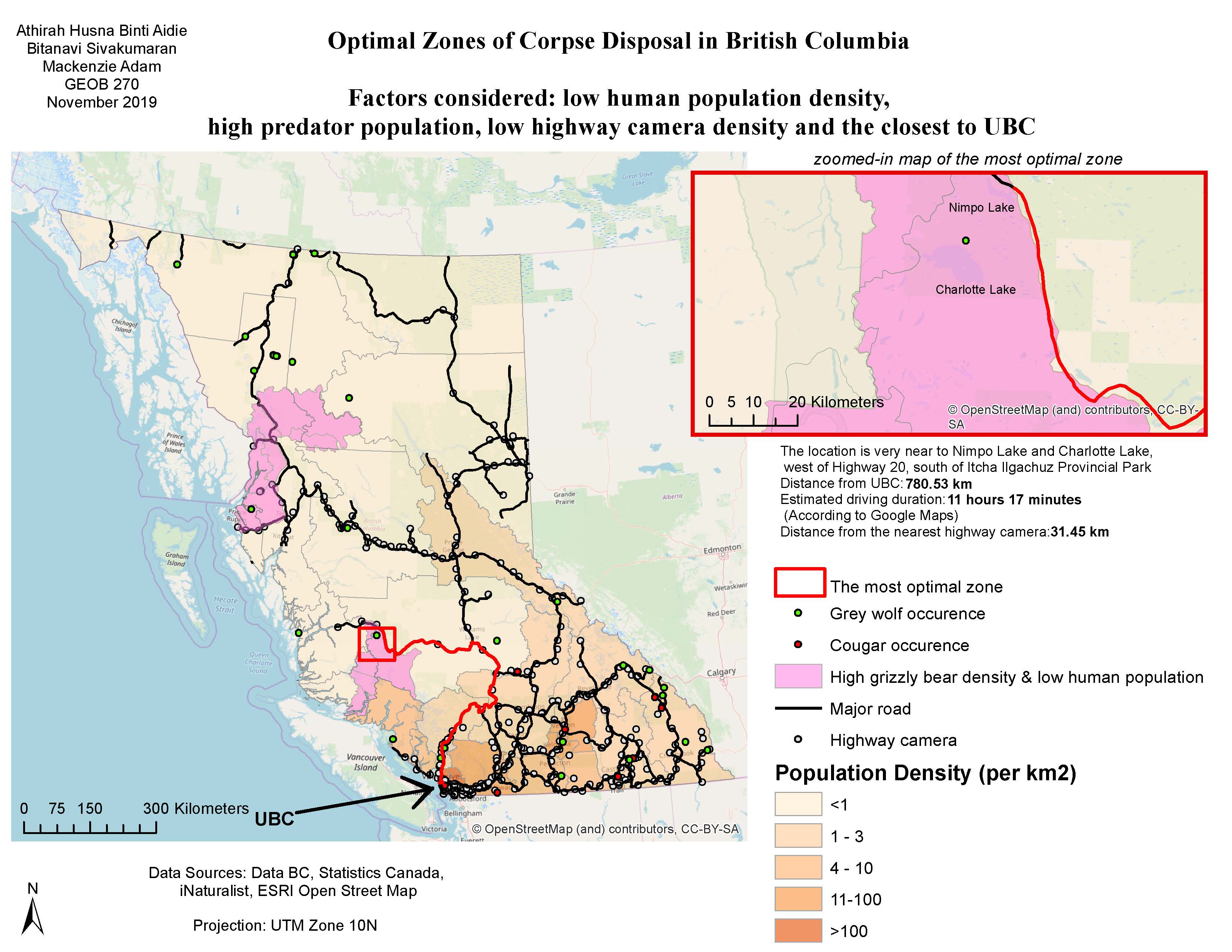
In Map 2, we chose high predator density as our key attribute because these predators can potentially consume corpse remains and therefore help in vanishing them. As a result, we found out that the small lakes alongside Highway #20 near Nimpo Lake to be the most optimal zone for corpse disposal. Nevertheless, it would take approximately 11 hours 17 minutes to get there by car from UBC.
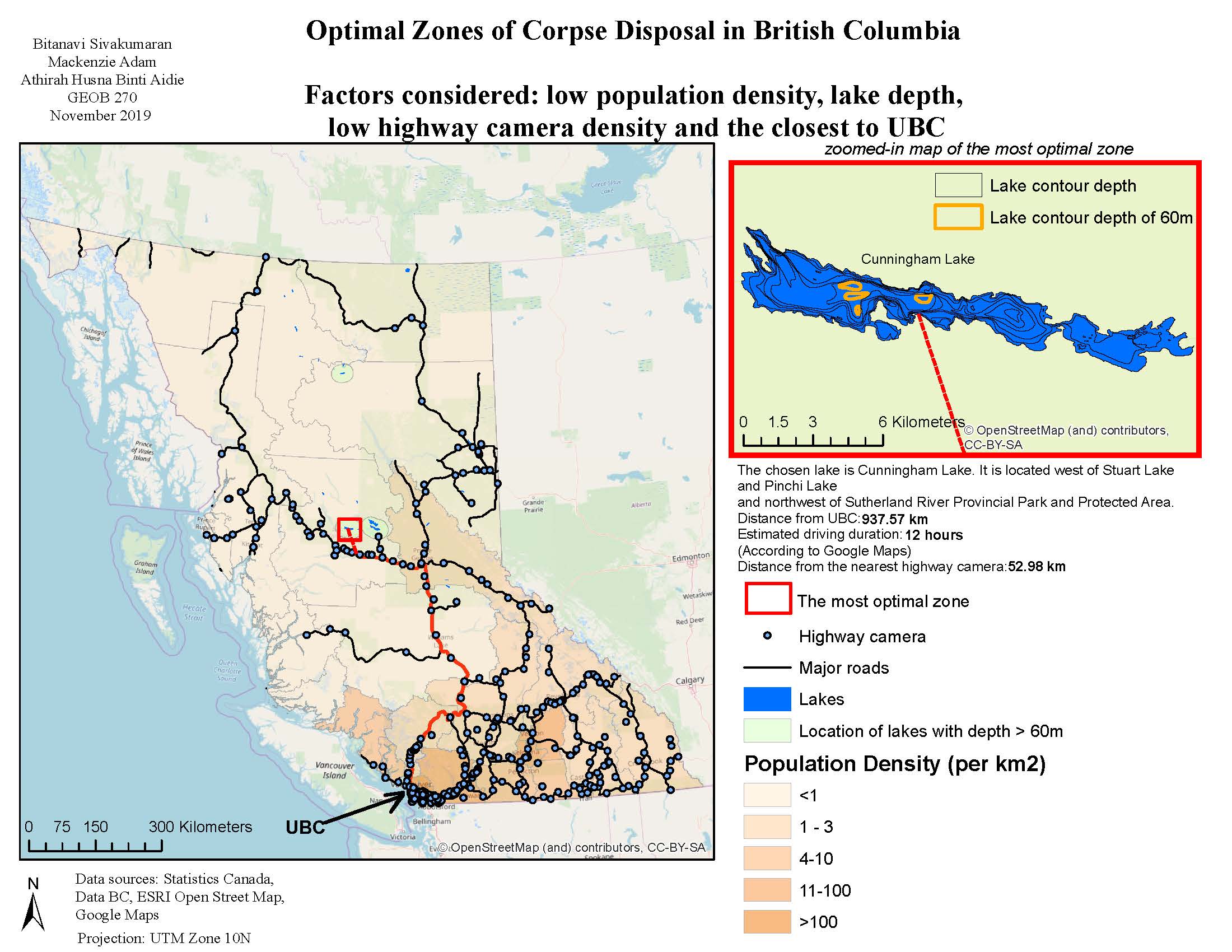
In Map 3, we chose deep lakes as our key attribute because we believe that the criminals can easily dispose the corpse by tying it to a big rock and dumping it into the lake. The most optimal lake to do so was revealed to be Cunningham Lake in Bulkley-Nechako C, BC as it is a quite deep lake and is very remotely located. However, just the previous two locations, it would take quite a long time to get to this lake from UBC by car which is 12 hours.
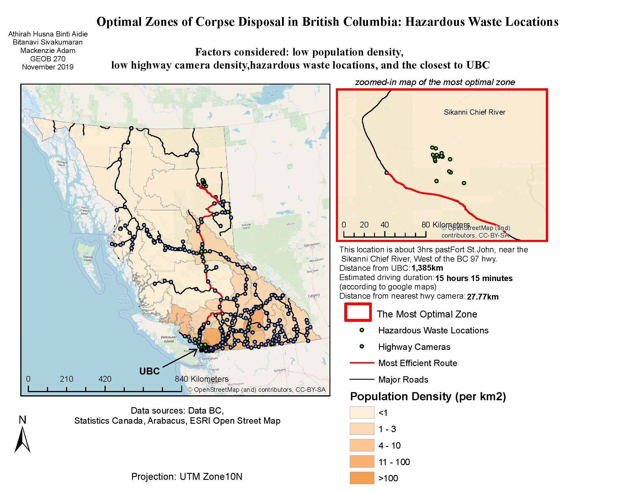
In Map 4, we chose hazardous waste locations as a key attribute because we suspected that the criminals might intend to use flesh-eating chemicals to help in vanishing the corpse. We discovered that the most ideal place for this crime was located in hazardous waste locations near Sikanni Chief River. However, it would take approximately 15 hours 15 minutes to get to this place by car from UBC.
We concluded that while there are certainly some areas in BC that awfully ideal for illegal corpse disposal, these areas are located very far away from UBC and therefore would be less of a problem for civilians living in the lower mainland. However, this might be a greater risk for people living in more remote areas of BC and therefore local authorities should conduct regular patrols at these locations to prevent these places from becoming murder or kidnap spots. We also discovered that there are surprisingly very few highway cameras in highways located in the Northern parts of BC and hence, should be increased. We intentionally excluded islands from our analysis because we figured that it would have been harder to hide a body in the car while trying to cross the body of water by ferry. However, future research should try to include islands in this analysis so that a more accurate and reliable outcome can be found.
Here are my accomplishment statements for this project:-
1. Acquired data from online dataset sites such as Data BC and iNaturalist to create layers and eventually maps from this dataset
2. Created a flow chart illustrating the steps taken to make a map by using Lucid Chart online software
3. Made a project proposal by using a template given on Canvas
4. Learnt how to divide tasks in a group assignment by ensuring each member received a fairly similar workload
5. Integrated and incorporated tools learnt before such as buffer, clip, join, select by attributes and union to make decent, publishable maps
Although we faced some difficulties while trying to complete this project, it was still an enjoyable process and I am grateful to have such cooperative members in my group. Overall, I really enjoyed this course and it does make me considering to take more GIS courses in the future.
That's all from me, thank you for a fun term!